Wide World Maps & MORE!
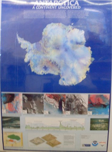
Antarctica: A Continent Uncovered [Map] Imposing Images and Joy Perrett
With an area almost twice the size of Australia and the USA, and with one of the most inhospitable environments on Earth, the Antarctic represents a landmass for which remote sensing techniques often provide the only means to gather information about this important continent. This importance stems from the influence of ice in shaping our world today and in the past. The World Climate Research Programme has acknowledged the huge significance of the Antarctic ice sheets in affecting our climate and sea level by incorporating data about this hostile environment into its global circulation models. Along with the world's leading research organisations, the National Remote Sensing Centre (NRSC), the UK's centre of expertise on the use of remote sensing techniques for Earth observation, has contributed to the gathering of vital information about Antarctica with the production of the digital mosaic shown here. Made up of a patchwork of 28 AVHRR images acquired by NOAA's TIROS-N series of satellites, the mosaic, which was five years in the making, provides an unique panorama of the whole Antarctic continent. This poster also includes examples of other data sets archived at the Royal Aerospace Establishment and elsewhere which the NRSC accesses.
Paper, one-sided wall map.
Size: 24"x33"


