Wide World Maps & MORE!
Wide World of Maps, Inc. Arizona Milepost Map: Interstate, U.S., & State Highways Gloss Laminated [Map] Phoenix Mapping Service
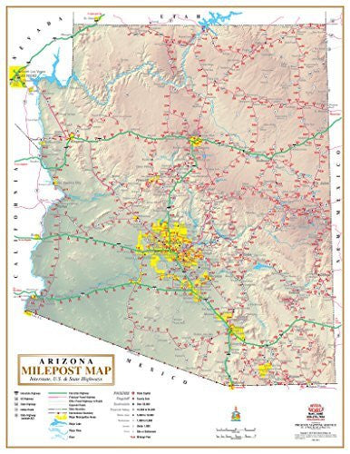
Phoenix Mapping Service is proud to present a map to all of the highway mileposts in the State of Arizona. Each interstate, each U.S. highway, and each state highway has a milepost listed for every ten miles. This one-of-a-kind map is what every statewide business needs!
You'll never have to worry about your drivers again! Employers can gauge what kind of mileage to expect from their drivers. Dispatchers will know more clearly where their drivers are when given milepost markers. Drivers can warn their bosses how much longer a drive might take when routing around detours. You won't know what you did without it!
The base map of Arizona features hypsography and shaded relief. Atop that base are interstate highways, principal paved highways, other paved highways & roads, state boundaries, the international boundary, major metropolitan areas, major lakes, major rivers, other rivers, the state capital, county seats, cities and towns by population, sites or settlements, and mileage posts. Highways are differentiated by interstates, U.S. highways, Arizona state highways, Indian routes, and other state highways. The map also includes scale bars for both miles and kilometers.
Gloss Lamination features premium optically clear film which provides a high shine for dramatic color presentation. It makes the surface of the map great for use with wet erase markers, sticker dots, and/or graphic tape.
Two-sided gloss laminated paper, one-sided wall map.
Size: 22" X 28"


