United States Department of Agriculture
Map: Northern Chiricahua Mountains [Paperback] National Forest Service
$ 29.95
$ 44.95
Scale - 1" to the Mile
Topo Lines - Yes
Plastic
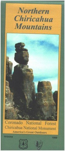
While not the highest mountains in southeast Arizona, the Chiricahua Mountains are the most massive. Explosive volcanism and continental uplifting 50 to 75 million years ago formed the mountains of this region. Further periods of volcanic activity and long-term erosion shaped the Chiricahuas into what they are today. Volcanic outflows combined with ash and dust to form "welded tuff". Time has weathered this material into unique pinnacles, balanced rocks, and caves now found in these mountains.
40387.1999ed