No Products in the Cart
Since time immemorial, humanity has been drawn to the ocean. Captivated by its power and lured by the mysteries it holds - and the mysteries that lay just beyond it - we have found ways to explore it, to travel on it and to map it. And many have been laid to rest beneath its murky depths.
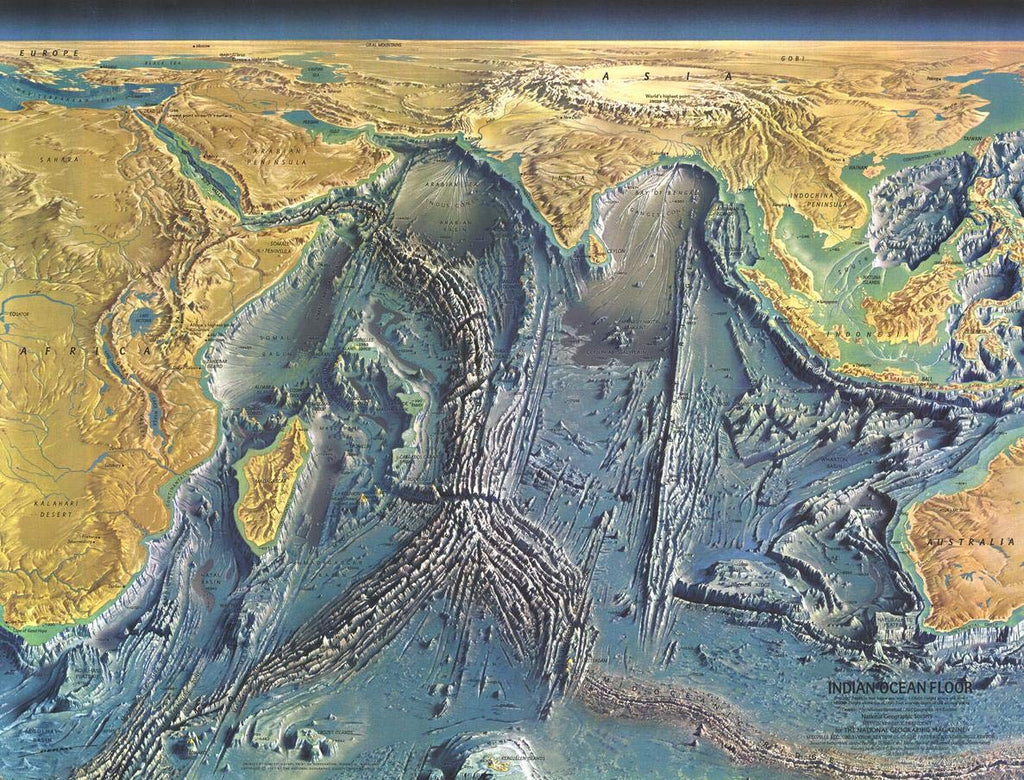
"Science explores the monsoon sea." This striking portrait of the Indian Ocean seafloor was the result of the International Indian Ocean Expedition that lasted more than six years with scientists from more than 30 participating nations.
This incredibly distinctive physical map of the Indian Ocean floor appeared in the October 1967 issue of National Geographic, and details submarine terrain such as continental shelves, basins, fracture zones and the mighty Mid-Oceanic Ridge. Explore the depths of the lowest crevices and see how the land masses rise up above the waves.
This map is a painting based off of bathymetric surveys - studies that allow us to measure the depths and characteristics of the ocean - and is a true work of art. A wonderful companion to the ocean floor maps of the Atlantic (1968), Pacific (1969) and Arctic (1971).
Your laminated map has a glossy finish so that you can use dry erase markers on the map to highlight features, make plans, and share unique information with others. Lamination is also extremely durable, resistant to folding or ripping.
Your map is rolled and packaged in a sturdy tube to protect it during shipment.
 As Seen On TV