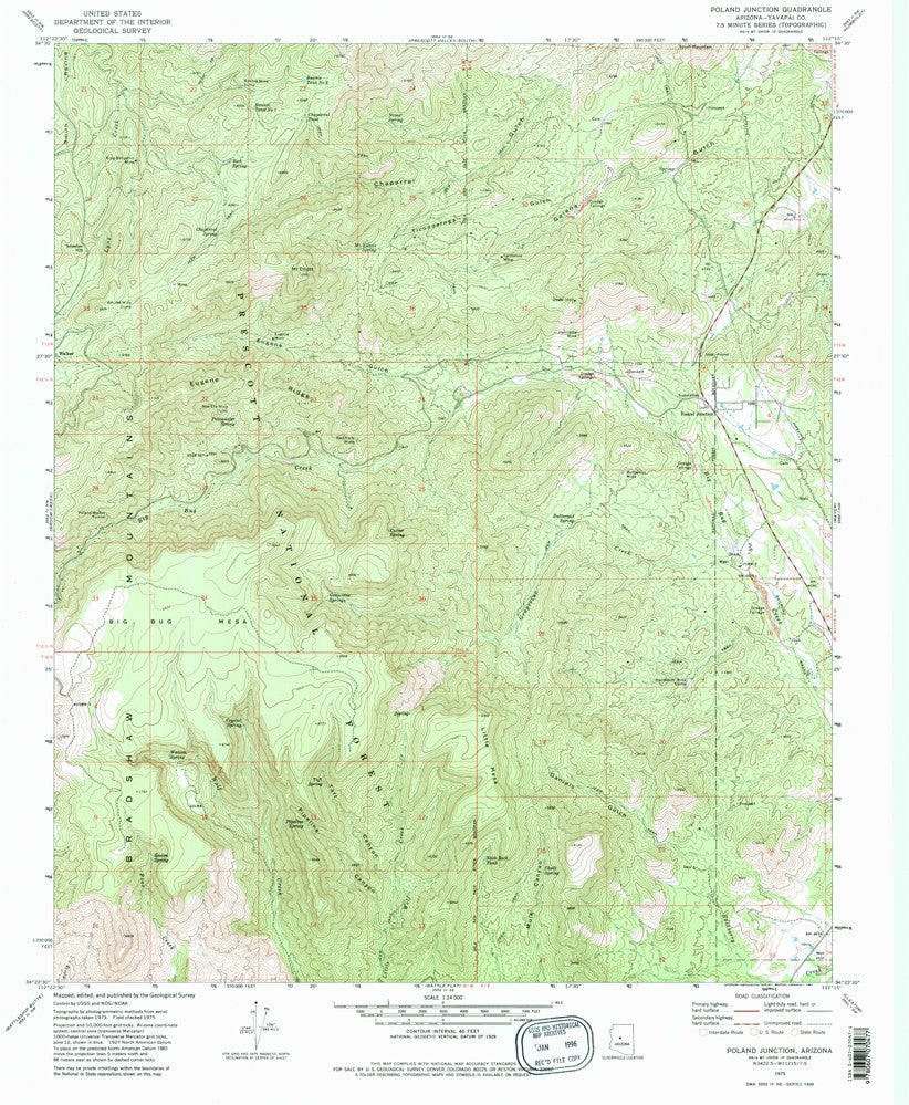

United States Department of the Interior
Poland Junction, Arizona [Map] U.S. Geological Survey
$ 15.95
$ 20.95
Long Name: Poland Junction, Arizona Historical Map 7.5'x7.5' Grid 24000-Scale 1975
Scale: 1:24,000
Content: Contours
Alternate ID: TAZ1133
ISBN: 978-0-607-07047-7
Version Date: 1975
Regions: AZ
Nations: USA
Latitude: 34° 22′ 30″ N to 34° 30′ 0″ N
Longitude: 112° 22′ 30″ W to 112° 15′ 0″ W
Media: Paper
Format: Flat
Description: USGS US Topo 7.5 - minute quadrangle map of Poland Junction, AZ
Survey Date: 1975
Print Date: 1981
Height In Inches: 26.800
Width In Inches: 22.000
Boundary Type: Quadrangle
UTM Grid: Yes
Horizontal Datum: North American 1927
Two Sided: No
Pieces: 1
Languages: English

![Arizona Road and Recreation Atlas [Paperback] Benchmark Maps - Wide World Maps & MORE!](http://maps4u.com/cdn/shop/products/81WodCcaVHL_large.jpg?v=1742587807)


