
Wide World Maps & MORE!
Topographic Recreational Map of Colorado (Detailed Travel Map) [Map]
$ 9.95
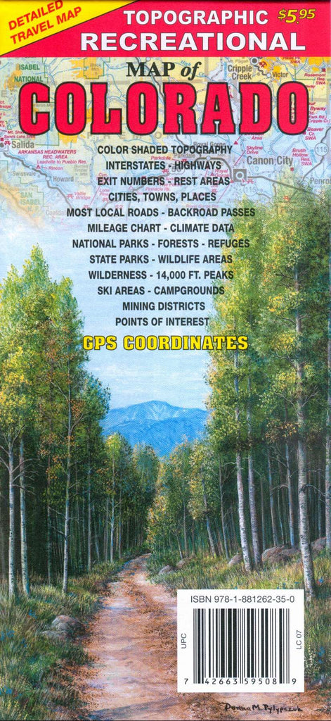
Detailed travel map ? Interstates, exit numbers, highways, and most local maintained roads. Topographic contours each 1,000 feet. Color shaded each 2,000 feet above 6,000 feet. Features include national forests, wilderness, campgrounds, parks, state wildlife areas, ski areas, mining districts, points of interest, and more. New 2019 Edition includes GPS coordinates and multiple updates.
- ISBN 13: 978-1-881262-35-0
- UPC: 7 42663 595089
- Size: 37" ? 24" .. Folded: 4-1/8" ? 9"
- Scale: 1 in. = 12.5 miles
- Paper .. 2019 Edition


![Rand McNally Folded Map: Western United States [Map] Rand McNally - Wide World Maps & MORE!](http://maps4u.com/cdn/shop/files/71tmkjvOOpL_f1e4e00a-cbbd-44c0-b3e8-9cb5819bb183_large.jpg?v=1741284623)
