MyTopo
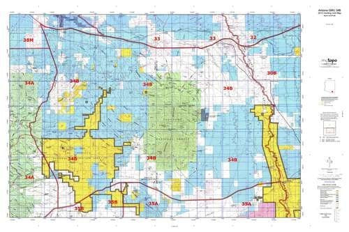
Arizona GMU 34B Hunt Area / Game Management Unit (GMU) Map
Arizona GMU 34B, Hunting Unit Map, 36" × 24"
MyTopo Hunt Area / Game Management Unit (GMU) Maps are 1:100,000-scale maps using the Bureau of Land Management Land Status base maps. These maps include public land ownership boundaries, topography, roads, and key terrain features. The selected State hunt unit or game management unit boundary is overlaid on the BLM base.
New Road Updates: MyTopo GMU maps now contain updated 2013 National Forest and public land roads sourced directly from the US Forest Service and other government agencies.
New Tank and Water Source Locations: Arizona GMU maps show official Arizona Game and Fish water source locations (tanks, reservoirs, and springs).
- Two-sided, self-cover, plastic folded map
- Species: All
- Map Size: 36" × 24"
- Hunting unit map of Arizona Game Management Unit 34B with topographic lines and unit boundaries. This topo map features UTM / MGRS and Latitude / Longitude grids, plus public land ownership. It comes folded on waterproof paper.
- This map contains the following named places: 85616, 85637, Adobe Tank, Anderson Canyon, Andrada Ranch, Andrada Tank, Apache Canyon, Apache Mobile Park, Apache Peak, B Smith Ranch, Barrel Canyon, Barrel Tank, Bates Tank, Beach Tank, Bear Spring Canyon, Benson, Bill Williams Tank, Blacktail Tank, Bluejay Mine, Boedecker Tank, Boquillas, Boston Gulch, Boulder Tank, Burro Gap, California Gulch, California Mine, California Wash, Camp Cameron, Cave Creek, Cedar Canyon, Cemetery Tank, Cherry Canyon, Cienega Ranch, Cinco Canyon, City of Benson, Clifford Wash, Clyne Ranch, Clyne Well, Cochise County Western Regional Landfill, Cochise Terrace Recreational Vehicle Resort, Colorado Gulch, Cooper World Mine, Corner Tanks, Corona de Tucson, Cottonwood Canyon, Cottonwood Peak, Cottonwood Saddle, Cottonwood Windmill, Cuprite Mine, Curtice Mine, Curtiss, Death Trap Canyon, Dimple Mine, Dirt Tank, Douglas Ranch, Dragoon Wash, Dry Canyon, Duck Tank, East Dam, East Fork Davidson Canyon, East Peak, East Sawmill Canyon, Easter Mountain, Empire Gulch, Empire Mountains, Empire Ranch, Enzenberg Canyon, Escalante Crossing, Escalante Wash, Fenner, Fish Canyon, Fish Well Corral, Fortynine Wash, French Joe Camp, French Joe Canyon, French Joe Peak, French Joe Tank, Fresno Canyon, Gardner Canyon, Gardner Ranch, Glenn Spring, Golden Gate Mine, Granite Mountain, Granite Peak, Great Spring Tank, Greaterville, Greaterville Gulch, Guidani Loop Trail Head, Guindani Canyon, Gunsight Pass, H & D Mine, Hammond Ranch, Harts Butte, Haystack Mountain, Heart S Ranch, Heavy Weight Mine, Helena Mine, Helvetia, Hidden Valley Ranch, High Haven Ranch, Highway Canyon, Highway Tank, Hillton Ranch, Hilton Mine, Hilton Wash, Homestead Tank, Huachuca Substation, Hummel Ranch, Jay Six Ranch, Jog Tank, Johnson Ranch, Jones Quarry, Kartchner Caverns State Park, Kellar Ranch, Kentucky Camp, Kentucky Gulch, Land, Las Cienegas National Conservation Area, Little Fish Canyon, Lobo Pass, Lone Pine Saddle, Lone Star Mine, Lonesome Valley, Lopez Pass, Los Posos Gulch, Los Posos Tank, Louisiana Gulch, Lower Tank, Martinez Ranch, Mattie Canyon, McCleary Canyon, McNalley Tank, Mescal Creek, Mesquite Tank, Middle Canyon, Middle Canyon Wash, Middle Tank, Mill Canyon, Mine Canyon, Mine Tank, Missile Tank, Montosa Canyon, Morning Star Mine, Mount Bruce, Mount Fagan, Mount Fagan Ranch, Mountain King Mine, Mud Spring Canyon, Mulberry Canyon, Mulberry Tank, Murphy Ranch, Mustang Peak, Narragansett Mine, New Tucson, North Basin Tank, North Canyon, North West Dome, Oak Tree Canyon, Oakdale Tank, Oil Well Canyon, Oil Well Tank, Old Dick Mine, Omega Mine, Ophir Gulch, Pantano Substation, Papago Canyon, Pato Blanco Recreational Vehicle Resort, Pauline Mine, Pimaco Two, Pomerene Canal, Post Ranch, Pump Canyon, Rain Valley, Rain Valley Ranch, Ramsey Tank, Ricketts Mine, Ricketts Storage, Road Tank, Rosemont Camp, Rosemont Junction, Round Corral, Sacaton Tank, Sacaton Wash, Saint David, Saint David Ditch, Saint David Substation, San Pedro Mobile Home Park, San Pedro Recreational Vehicle Resort, Sands Ranch, Sands West Camp, Sanford Canyon, Santa Rita Golf Club, Sawmill Canyon Tank, Sawmill Canyon Trail 146, Scholefield Canyon, Sheep Wash, Shellenberger Canyon, Siemond Ranch, Silver Tank, Simpson Tank, Slavin Wash, Smith Canyon, Snyder Mine, South Fork Middle Canyon, Spring Water Canyon, Stevenson Canyon, Stoddard Ranch, Sucker Gulch, Sycamore Canyon, The Cape, The Lake, The Narrows, Thurber Ranch, Tombstone Territories Recreational Vehicle Resort, Total Wreck Mine, Trail Canyon, Turquoise Hills Family Golf Center, Twin Buttes, Twin Tanks, Upper Tank, V R Camp, Wakefield Canyon, Wasp Canyon, Weigles Butte, Whetstone, Whetstone Business Park, Whetstone Mountains, White Tank, Wild Cow Canyon, Williams Ranch, Willow Canyon, Wilson Ranch, Wind Tank, Wisconsin Mine, and Wood Canyon


