R.I.P. Robert Molner, founder of Wide World of Maps, Inc.
Cart 0
Arizona Hunt Unit 21 Map - Wide World Maps & MORE! - Map - Adventure iDiaz Maps - Wide World Maps & MORE!

Adventure iDiaz Maps

Arizona Hunt Unit 21 Map

$ 36.95 $ 49.95

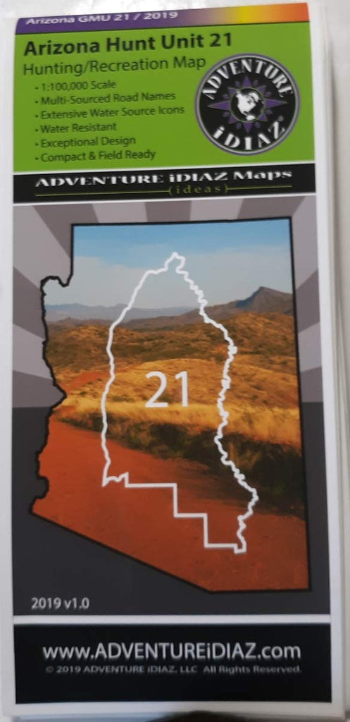
Hunt Unit 21 offers a variety of habitats: from the North, the Verde River basin that gradually climbs to mountainous zones with pinyon-juniper belts along with some ponderosas, breaking into rolling hills & high chaparral; to its South & East lies some of Arizona's best Sonoran Desert habitat that ties along the Verde River system; & its West area harbors deep beautiful canyonlands containing the Agua Fria River.

This popular unit lies within the Prescott & Tonto National Forests & is home to small pockets of private, BLM, & State lands. Hunt Unit 21 offers trophy big game hunting for mule deer, whitetail, antelope, mountain lion, & javelina. Furthermore, great opportunities for small game such as bobcat, coyote, fox, cottontail rabbit, quail, & more are found within its boundaries.

Unit 21 contains two important wildlife preserves as well as a National Monument. The Cedar Bench Wilderness offers elevations starting at 4500 feet & climbing up to 6700 feet with vegetation of chaparral, pinyon, & junipers & over 30 miles of scenic hiking trails. The Pine Mountain Wilderness offers elevations over 6700 feet supporting pinyons, junipers, & some ponderosas with over 35 miles of spectacular hiking trails.

Furthermore, the Agua Fria National Monument contains two mesas along with a deep canyon carved by the Agua Fria River covering over 70,000 acres. The elevations range from 2100 feet to 4600 feet offering a unique diversity of vegetative & wildlife communities. This monument contains one of the most significant systems of prehistoric sites in the Southwest.

Hunt Unit 21 contains two major reservoirs, Bartlett & Horseshoe. These lakes offer excellent fishing for largemouth bass, crappie, channel, & flathead catfish. These game fish are also plentiful throughout the entire Verde River.

Due to the primitive nature of the roads combined with weather conditions, access demands 4×4 off road vehicles in order to safely venture throughout the unit. Please be mindful that there are numerous reasons why some road restrictions exist within National Forests. Please be mindful & respect the protection given to the land & resources by these closures & restrictions.

Public lands are subject to leasing & other changes. It is advised to obtain local & forestry information from a Forest Service office or other public land agency. Contact the appropriate land management agency for the most current information.

The publisher has exerted its best efforts to portray, render, & compile current information. However, due to recent natural & other degradation, closures, or new additions of roads & trails, or land ownership changes, absolute accuracy cannot be guaranteed. The user must supply the experience, common sense, knowledge, & physical conditioning necessary for safe outdoor travel.

This map product is revised on a regular basis & subject to change. Adventure iDiaz Hunt Unit Maps are a tool supplement; therefore we will not be held liable nor responsible for any mishaps.

AZ Hunting Unit 21 Information

  • 1:100,000 Scale - Detailed Topographic Map
  • Multi-Sourced Road Names - Adventure Trails, 4 × 4 & Light Duty Roads
  • Water Resistant - Tear Resistant, Durable PolyPropolyn
  • Exceptional Design - Beautiful, High Quality Color & Detail
  • Compact & Field Ready - Easy To Read & Follow
  • Extensive Water Source Icons - Clearly Marked Water Tanks & Spring Symbols
  • 36" × 48" - Unfolded / 4.50" × 10.25" - Folded
  • One-sided, self-cover, plastic folded map.
  • 62021
iDiaz.AZ21

Share this Product


More from this collection