National Geographic Maps
Antarctica, 1-sided satellite image - Laminated - 20"H x 31"W
Explore the seven continents with National Geographic. Take an up-close look at each of the world's continents, which feature up-to-date information and National Geographic's world-renowned cartographic craftsmanship.
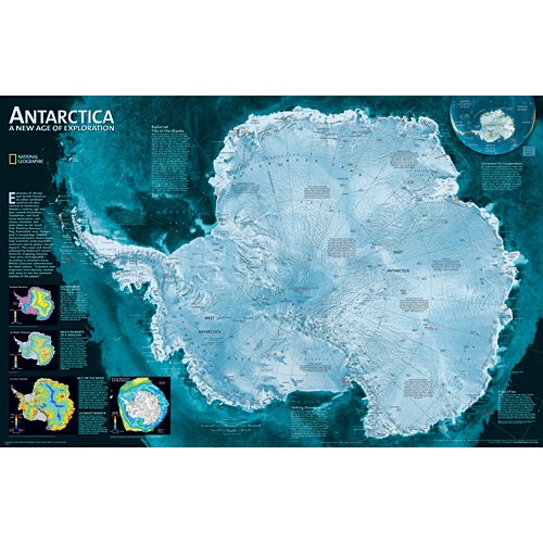
This National Geographic map features a striking view of Antarctica's terrain. The image — compiled from 4,500 satellite scans — provides a highly detailed view of the icy continent. Additional inset maps show surface elevation ice sheet thickness, velocity of ice flow and sea ice movement, and wind flow.
The map is encapsulated in heavy-duty 1.7 mil laminate which makes the paper much more durable and resistant to the swelling and shrinking caused by changes in humidity. Laminated maps can be framed without the need for glass, so the frames can be much lighter and less expensive. Satin Lamination features glare-reducing qualities that provide a soft sheen. A satin finish is best suited for backdrop prints and displays receiving indirect, bright lighting.
Ready-to-Hang maps have rails at the top and the bottom to keep the map flat against the wall with two loops on the top rail for easy hanging. A package of wall hooks and nails completes the set.
- 31" × 20" ready-to-hang, satin laminated, one-sided wall map