No Products in the Cart
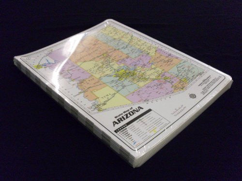
This twenty-count set of 16" x 18", full-color, two-sided laminated maps where each is actually a desk-sized collection of Arizona maps is perfect for classroom use. One side of each map features an Arizona map showing highways, cities by population, counties, waterways, and points of interest. Three insets feature maps of the USA, the metropolitan Phoenix area, and the Earth's poles & hemispheres. The other side of each map features an Arizona map showing an artistic hypsographic shading that depicts elevation with waterways in blue and county lines in gray and yellow. Four insets feature maps of official Arizona symbols, Arizona land form regions, Arizona native nation (American Indian) lands, and Arizona climate regions. The heavy, markable, and washable lamination makes these durable desktop maps popular items for classrooms and exhibits. These maps are a great reference for any occasion!
 As Seen On TV