Wide World Maps & MORE!
Arizona State Map (Markable Surface Maps) [Map] Rand McNally
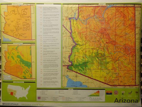
This is the ultimate educational map for the State of Arizona of the United States of America. The surface of this wall map is markable with water-soluble markers, making is great for temporary annotations while learning.
The main map showcases the Copper State with hypsographic topography, land features, water features, cultural features, & population centers. Below the main map are the official state flag, seal, flower, bird, & tree.
To the right of the main map are three inset maps. The top inset is a map of Arizona Indigenous Nations with the year of the establishment of their Reservation. The middle inset is a map of the climate regions. The bottom inset is a map of the United States highlighting Arizona and its neighboring states.
Between the main map and inset maps is a chronology of historic events from within the State of Arizona. Face it, this map has everything you need to learn the basics about the Grand Canyon State!
One-sided, wall map.
Size: 70"x52"


![Arizona Road and Recreation Atlas [Paperback] Benchmark Maps - Wide World Maps & MORE!](http://maps4u.com/cdn/shop/products/81WodCcaVHL_large.jpg?v=1742587807)

