No Products in the Cart
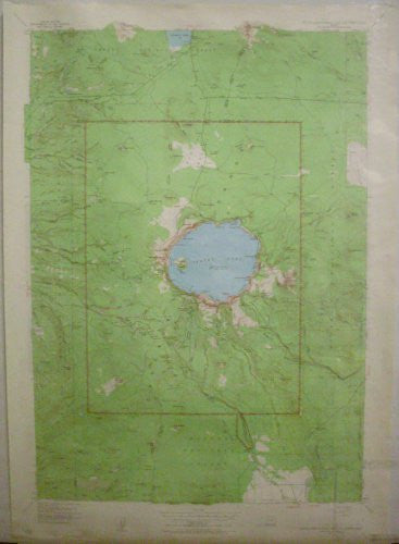
USGS's Crater Lake National Park and Vicinity, Oregon is a 25 x 26 minute political, road, topographic, and recreation map all-in-one! The reverse side features a complete write up of the national park, complemented by maps, diagrams, paintings, and a photograph.
Paper, two-sided wall map.
Latitude = 42° 43' 0" N to 43° 9' 0" N
Longitude = 122° 20' 0" W to 121° 55' 0" W
Scale = 1:62.5k
Projection = Polyconic
UTM Zone = 10
Horizontal Datum = North American 1927
Contour Interval = 50' topographic
Size = 25" x 36"
 As Seen On TV