R.I.P. Robert Molner, founder of Wide World of Maps, Inc.
Cart 0

Adventure iDiaz Maps

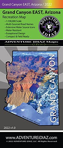
Grand Canyon East Recreation Map

$ 36.95

Arizona boasts hosting the Grand Canyon, one of the most unique landforms on Earth — one of the Seven Natural Wonders of the World. As one of the most popular outdoor vacation spots for tourists & locals, millions of visitors worldwide have made it a favorite destination since it became a National Park in 1919. From rim to rim, the scenery & grandeur that the park offers will lead to unforgettable adventures!

Public lands are subject to leasing & other changes. It is advised to obtain local & forestry info from a Park Service office or other public land agency. Contact the appropriate land management agency for the most current info.

To explore the terrain outside of the traditional tourist areas around the Grand Canyon, a high clearance 4×4 vehicle is mandatory due to primitive roads & weather conditions. Please check the Kaibab National Forest, Grand Canyon National Park Services, & respective Native American Indian Administration(s) for their restrictions before your adventure. Roads open & close without notice. Please observe & respect road signs.

The publisher has exerted its best efforts to portray, render, & compile current info. However, due to recent natural & other degradation, closures, or new additions of roads & trails, or land ownership changes, absolute accuracy cannot be guaranteed. The user must supply the experience, common sense, knowledge, & physical conditioning necessary for safe outdoor travel.

This map product is revised on a regular basis & subject to change. Adventure iDiaz Recreation Maps are a tool supplement, therefore will not be held liable or responsible for any mishaps.

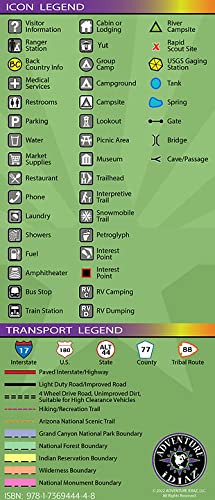
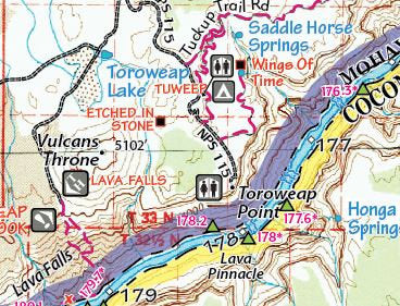
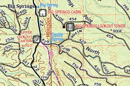
Whether you're a hunter, fisher, hiker, biker, camper, skier, all-round outdoors-person, or just love getting out in your 4×4, our 1:100,000-scale Grand Canyon East Recreation Map has been made with great passion, excellence, & with an eye for beautiful design. A multi-source approach to information gathering ensures rich content.

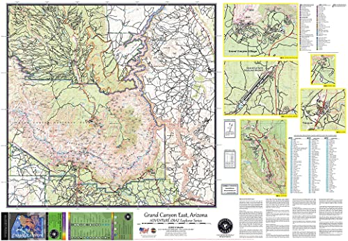
The most popular tourist areas are captured in our Grand Canyon East Recreation Map which includes the North and South Rim areas, Grand Canyon Village, Tusayan, Grand Canyon National Airport, Desert View, Saddle Mountain Wilderness Area, Kaibab National Forest, and the western portions of the Navajo Nation Indian Reservation.

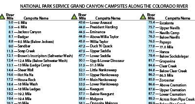
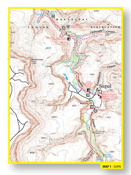
Both folded field maps contain blown-up inserts for the most popular areas as well as detailed Colorado River mile marks with river campsite and scout-sites along both banks of this mighty river.

Here are some interesting Grand Canyon facts that are amazing!

Elevation/Terrain:
The Grand Canyon’s deepest location is Mather Point, which is nearly one mile deep and ten miles across. In 1978, there was a record snowfall at over 23 feet on the North Rim of the canyon. In 1985, the park’s record low was minus 23 degrees Fahrenheit. The highest intermittent waterfall, Cheyava Falls, drops 800 feet into the Colorado River. The highest perennial waterfall is Mooney Falls at 196 feet. The greatest vertical drop-off in the Colorado River is Hance Rapid at almost 30 feet. The highest viewpoint is Imperial Point at 8,803 feet. The oldest artifacts are Clovis projectiles, which is said to be 12,000 years old. The Grand Canyon has about 277 river miles from Lee’s Ferry to the Grand Wash Cliffs. North America’s largest wing spanned bird of 9 ½ feet, the California Condor lives in the Grand Canyon. The diversity in climate, wildlife, and rock formations create a stunning and explosive natural color palette that is rare in the high desert.

The Grand Canyon is geologically unique because it contains intact geological history with its strata representing all rock form groups, metamorphic, igneous, and sedimentary rock along with the many theories of formation.  Some scientists and geologists believe its strata dates back to 1.8 b.y.  Today, the canyon continues to attract geologists from all over the world.

The Grand Canyon hosts over 1400 plants between Sub-Alpine Zone of 8500 ft to lower elevations of the Inner Gorge the Mojave Desert. The highest elevations contain Engelmann spruce,  Aspen, and furs with scattered meadows leading to Ponderosa Pine, a scenic viewpoint that exposes breathtaking drop offs. The mid elevations continue with pockets of Ponderosa that change into pinyon/juniper belts along the canyon with a mix of oak thickets. From this viewing point, it further descends into chaparral yielding shrubs, cacti, yucca. This  similar plant life continues  down to the hotter climate of the Mojave Desert inside the Inner Gorge.

Variety of Wildlife:
The wildlife at the Grand Canyon has 91 species of mammals, 450 species of birds, 58 species of reptiles and amphibians, and 23 species of fish.

Birds:
The skies of the canyon offer a mega habitat for birding. Feathered friends who live in the park include the large California condor, turkeys, eagles, falcons, hawks, and owls. Some of the smaller varieties include wrens, jays, ravens, kingfishers, and flycatchers to name a few.

Reptiles and Amphibians:
The canyon walls are crawling with some of the most interesting reptiles of the desert, such as the  yellow-backed spiny lizard, the greater short-horned lizard, Gila monster, and the Grand Canyon pink rattle snake. Amphibians are found throughout the different ecosystems of the park: the canyon tree frog, the northern leopard frog woodhouse toad, and the tiger salamander.

Some of its common mammals are mule deer, desert bighorn, American bison, elk, black bear, mountain lions, fox, Kaibab squirrel, and other critters.

Fish/Fishing:
The Grand Canyon contains five species of its own native fish, such as the speckled dace, razorback, bluehead and flannelmouth suckers, and humpback chub. There are three important native fish that are now considered endemic due to dam construction and introduction non-native fish of trout. These are the roundtail chub, bonytail chub and the largest Colorado pike minnow which can grow up to 6 feet in length. Popular non-native fish include brown and rainbow trout. The trout feed on the native fish, which has caused a takeover of the native habitat.

Outdoor Recreation:
The seven-wonder park is renowned for the vast options of outdoor activity. There are  over 125 hiking throughout;  Some trails are a full-day hike, and other options can include the multi-day adventuring loops, some connecting between the North and South Rim.  For more information, please contact the proper authorities for proper permits that are required. 

Park camping offers 327 developed campsites. Encampment areas offer a campfire ring/grill, picnic table, and parking spaces for up to six people. Contact the proper authorities for permits and other arrangements that are required.

Other outdoor adventure options include: rafting, snowmobiling, fishing, wildlife viewing, biking, horseback/mule riding and more.

Navajo and Havasupai Nations:
The Navajo and the Havasupai Native American Nations borders the Grand Canyon along the Southeast and Southwest borders, offering outdoor exploration that leads right into the Grand Canyon. History buffs will enjoy learning about the heritage of the indigenous tribes of Arizona.

The Navajo Nation runs along the Southeastern region. This particular tribe of Navajos are part of the Athabaskan group with a rich history in America. Their name means “people.”  The Navajo Nation is the largest reservation inside the United States. Their people originally were hunter-gatherers and farmers. Today the Navajo farm the land and also produce timber, oil, gas, coal, uranium, and other minerals.   The Navajo Nation offers numerous hikes along the Grand Canyon area such as Salt Creek, and Little Colorado and others. Camping, fishing, and hunting are also offered on the reservation. Food and lodging are available throughout the reservation. 

The Havasupai Nations people have been growing crops in the canyons and hunting on their plateaus for about 800 years. Their name means “the blue-green water people,” named after the hues of color in Havasu Creek. This area is world famous for its hiking along creek with its many waterfalls eventually flowing into the Grand Canyon. Other areas include Supai Village, Hilltop, and Cataract Canyon. This tribal region offers camping, fishing, horseback/mule riding, and other excursions. Food, lodging, and a store/café are  available to visitors.

  • One-sided, self-cover, plastic folded map
  • 861262-idiaz
iDiaz-GCEast

Share this Product