No Products in the Cart
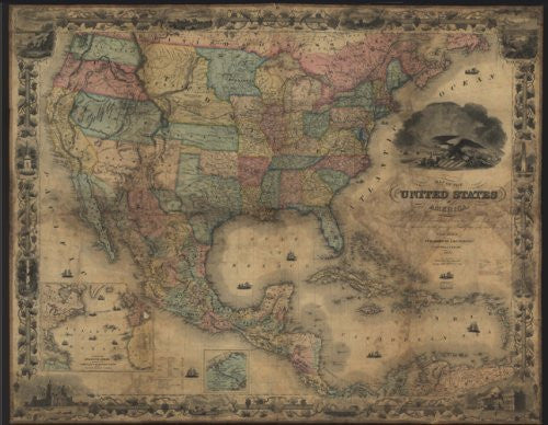
1857 (reproduction of the original) Map of the United States of America, The British Provinces, Mexico, The West Indies and Central America with part of New Grenada and Venezuela was originally published by J.H. Colton and Co., New York,. Two insets show: "A map of the Atlantic Ocean showing the American and European ports"; and "The Isthmus of Panama". Reproduction, one-sided, paper. Latitude: 8° 0' 0" N to 48° 0' 0" N Longitude: 500° 0' 0" W to 128° 0' 0" W
 As Seen On TV