No Products in the Cart
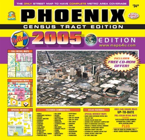
For years this atlas has been the people's choice for its quality and up-to-date information on the Phoenix Metropolitan Area. Its full-color maps, indexed listings, and fold-out map are professionally prepared with digital clarity. Each detailed street map covers a full township with the section numbers and Census Tracts clearly indicated. The alphabetical street index designates city, block number, grid location, and page number. Current city boundaries, lakes, schools, hospitals, libraries, parks, golf courses, and major shopping centers are clearly identified. Metropolitan maps of school district zones and ZIP code zones; enlarged sections of Downtown Phoenix and Scottsdale, the Central Corridor, Sky Harbor Airport, and Arizona State University; and a colorful, fold-out map showing the entire metropolitan area are all included. This is one atlas everyone should have!
 As Seen On TV