No Products in the Cart
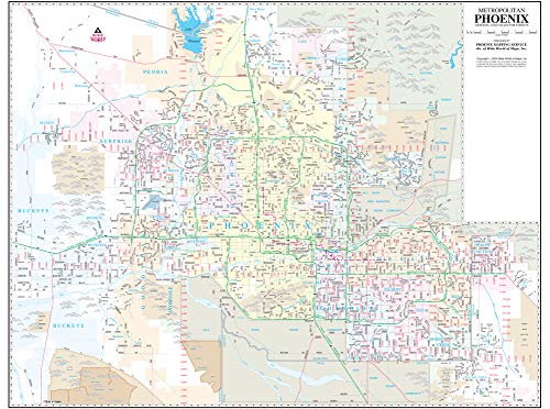
Phoenix Mapping Service's Metropolitan Phoenix Arterial and Collector Streets Full-Size Standard Wall Map Ready-to-Hang is a 47" × 36" wall map of the major and intermediate streets in the Phoenix metropolitan area. View the entire metropolitan area on a single dry erase laminated sheet that clearly shows the latest highways, streets, and light rail extensions.
The map displays major streets (arterial streets) and intermediate streets (collector streets), locates light rail lines, communities, block numbers, rivers, canals, and railways. It is popular for general reference and for locating businesses that are normally found on the arterial and collector streets. The colors are used to show the incorporated cities, making it easy to locate the official area of each city. The map grid corresponds to the index in the Phoenix "Yellow1" Street Atlas and other Phoenix Mapping products for easy cross-reference. This is a convenient and useful at-a-glance reference.
Ready-to-Hang maps have rails at the top and the bottom to keep the map flat against the wall with two loops on the top rail for easy hanging. A package of wall hooks and nails completes the set.
 As Seen On TV