No Products in the Cart
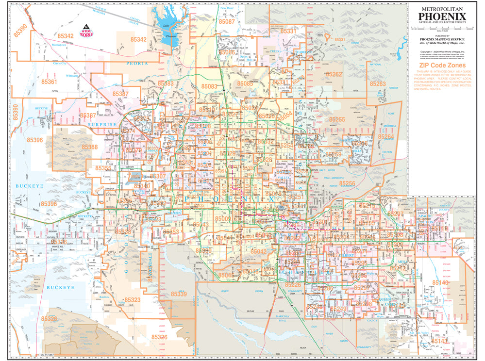
Phoenix Mapping Metropolitan Phoenix Arterial and Collector Streets Full-Size ZIP Code Wall Map is a 47" × 36" wall map of the ZIP codes and major and intermediate streets in the Phoenix metropolitan area. View the entire metropolitan area on a single dry erase laminated sheet that clearly shows the latest ZIP code boundaries.
The map displays major streets (arterial streets) and intermediate streets (collector streets), locates light rail lines, communities, block numbers, rivers, canals, and railways. It is popular for general reference and for locating businesses that are normally found on the arterial and collector streets. The colors are used to show the incorporated cities, making it easy to locate the official area of each city. The orange ZIP code overprint clearly shows the ZIP code boundaries and five-digit designations. The map grid corresponds to the index in the Phoenix "Yellow1" Street Atlas and other Phoenix Mapping products for easy cross-reference. This is a convenient and useful at-a-glance reference.
Dry Erase Lamination is specialty laminate that allows for dry erase markers to be used on the finished print and erased as desired.
 As Seen On TV