No Products in the Cart
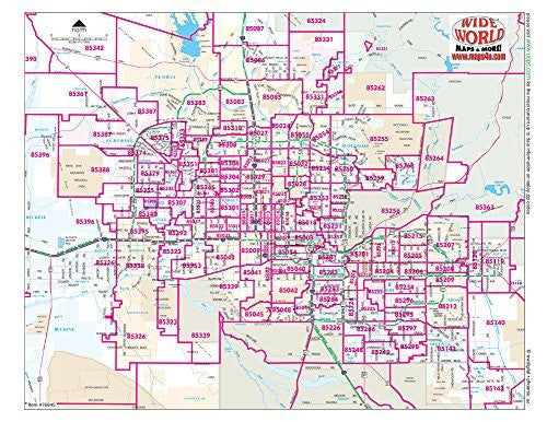
This gloss laminated notebook map is the map you need to present the entire Phoenix metropolitan area at-a-glance. It shows highways and major (arterial) streets with community names, Native American communities, national forests, rivers, lakes, and airports clearly labeled. The color image has a red ZIP code overprint of ZIP code numbers and boundaries for easy reference -- clear enough to read but small enough for easy storage or travel.
Gloss Lamination features premium optically clear film which provides a high shine for dramatic color presentation.
The map is a convenient and useful at-a-glance reference ready for wet erase or alcohol erase markers, sticker dots or arrows, or graphic tape.
10 Count Gloss laminated paper.
Size: 11" × 8.5"
 As Seen On TV