Spaceshots
Spaceshots Mexico from Space0169 Art Poster Print, 32x24
$ 26.95
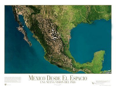
Mexico from Space: A New View of the Country
NOAA meteorological satellites provided the data and photography to create this map, which has been further enhanced by the addition of natural colors. The photo mosaic is made up of more than twenty satellite images.
It's possible to distinguish the temperatures of the oceans in this image; lighter colors represent higher temperatures. It's also possible to distinguish the desert and forested areas of Mexico.
Paper, one-sided wall map.
Scale: 1:4,250,000
Size: 32" x 24"


![Arizona Road and Recreation Atlas [Paperback] Benchmark Maps - Wide World Maps & MORE!](http://maps4u.com/cdn/shop/products/81WodCcaVHL_large.jpg?v=1742587807)
