No Products in the Cart
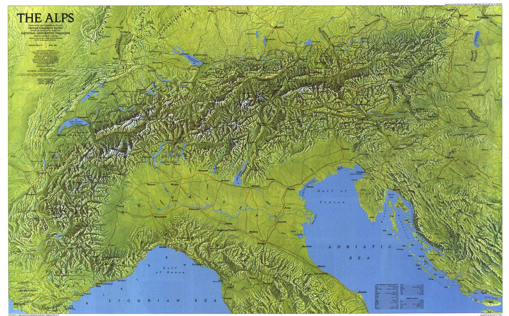
A great wall between northern Europe and the Mediterranean, the Alps have long harbored diverse inhabitants in magnificent isolation. Eight countries partition this 85,000-square-mile crescent where nature has always ruled supreme. This gorgeous relief map was published in April 1985 as part of a two-map set with The Traveler's Map of the Alps.
The entirety of Europe's snowy crown is displayed in a brilliantly painted panorama in this map. Depicting the mountains' sloping valleys, high peaks, and numerous mountain lakes, this map offers a complete aerial view of the range. By depicting highlights and shadows in colors faithful to the actual terrain, the cartographic artist achieved a striking and attractive three-dimensional effect.
International boundaries, major routes, and major cities are identified on this map, in addition to the sub-ranges, such as the Maritime Alps and the Bernese Alps. Included is also the signature of the artist, adding a final detail to a truly unique piece of art.
A gorgeous pictorial map of the European Alps, this map is a must-have for any collection. It makes a wonderful companion to 1965's The Alps, Europe's Backbone map, and to the Traveler's Map of the Alps, as part of a two-map set.
Your laminated map has a glossy finish so that you can use dry erase markers on the map to highlight features, make plans, and share unique information with others. Lamination is also extremely durable, resistant to folding or ripping.
Your map is rolled and packaged in a sturdy tube to protect it during shipment.
 As Seen On TV