No Products in the Cart
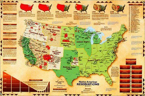
An extremely comprehensive map showing American Indian land from the time of Columbus and projected through 2100. Map also depicts tribes and reservations, including native populations. Insets include a Native American history and a chronology of events dating back to 1492. Map designed by George L. Russell, a Saginaw Chippewa. Size: 36 x 24
 As Seen On TV