
Phoenix Mapping Service
Phoenix Metropolitan School District Zones Gloss Laminated [Map] Wide World Digital
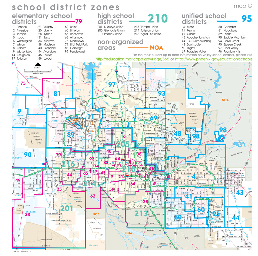
The perfect wall map for school administrators, substitute teachers, government agencies, or businesses, this wall map shows the boundaries of each school district and non-organized area. School districts are color coded by elementary, high school, and unified, as well as non-organized areas. This map includes highways, arterial (major) roads, lightrail, airports, rivers, lakes, regional parks, national forests, municipalities, and indigenous communities.
Gloss Lamination features premium optically clear film which provides a high shine for dramatic color presentation. The gloss lamination makes this map a convenient and useful detailed reference ready for wet erase markers, sticker dots, or graphic tape for locations, areas, and zones.
36" × 36" gloss laminated, one-sided wall map.
MapGGLAM