No Products in the Cart
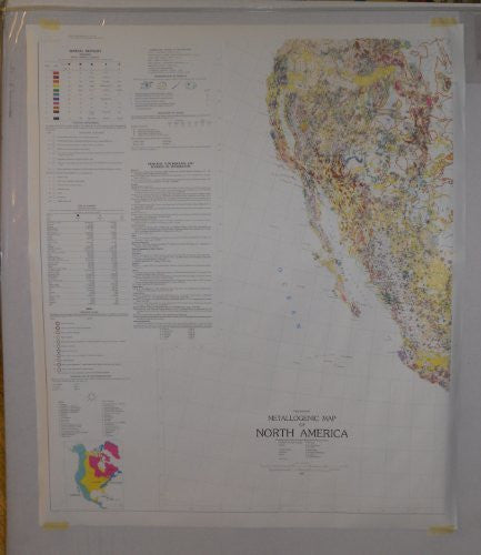
In an attempt to portray the mineral deposits of North America in their geological settings, the compilers of this map have departed from conventional practice and devised a legend which requires a little study to comprehend. The basic components are colors, shapes, and patterns, and orientation of the later two with respect to the nearest meridian. All stratified rocks of a given age range are shown in the same color; tints, patterns, and, for some, ornamentation indicates their nature and general structure and/or metamorphic condition. The essential petrologic nature of intrusive rocks is shown by color, and relative ages of the felsic intrusives by patterns which have different significance in the various major orogenic domains of the continent.
Mineral deposit information is portrayed in three manners: 1) Those localized deposits for which the symbols exceed the actual size they represent (and hence may obscure the geologic setting) carry "ticks" to indicate their geologic environment. 2) Districts and areas large enough to portray at their true size and shape are shown by outline and hatchuring, with or without a standard symbol to show importance and other information. 3) Outcrops (or suboutcrops) of extensive bedded ores are shown by lines, with or without symbols.
Paper, one-sided wall map.
Scale = 1:5,000,000
Size = 33" x 40"
 As Seen On TV