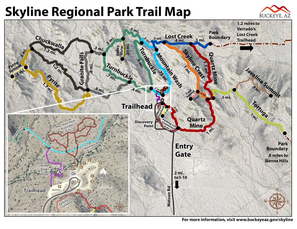
Skyline Regional Park features miles of trails for hikers, mountain bikers and equestrians. Dogs are permitted on trails but must be leashed.
- Park entry is FREE!
- Trails open sunrise to sunset. Gates close at 10 p.m.
The city of Buckeye's Skyline Regional Park is an 8,700 acre mountain preserve located in the southern White Tank Mountains. The park is located 2 miles north of the I-10 / Watson Road interchange at 2600 N. Watson Rd. Buckeye, AZ 85396.
 As Seen On TV