No Products in the Cart

 Everything is Somewhere
Everything is Somewhere
Everything is Somewhere
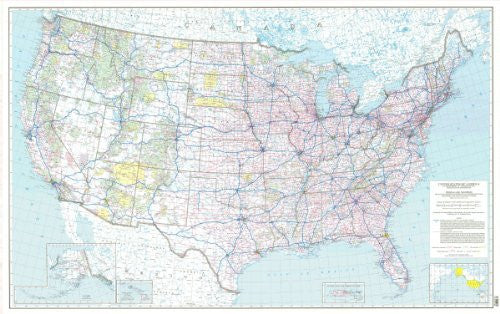
This map shows the National System of Interstate and Defense Highways and the Federal-Aid Primary Highway System. Information was compiled by the Federal Highway Administration with the assistance of the State highway departments. The map is an excellent tool for transportation planning. Shown are international and State boundaries and names, State capitals and major cities, rivers and lakes and national parks. Insets at various scales show the road systems of Alaska, Hawaii, and Puerto Rico. *** Map scale is 1:3,168,000 (1 inch = 50 miles) and measures 64.5 inches by 41 inches.
Paper, one-sided wall map.
Latitude = 26° 0' 0" N to 50° 0' 0" N
Longitude = 125° 0' 0" W to 67° 0' 0" W
Scale = 1:3,000,000
Size = 64.5"×41"
 As Seen On TV