Wide World Maps & MORE!
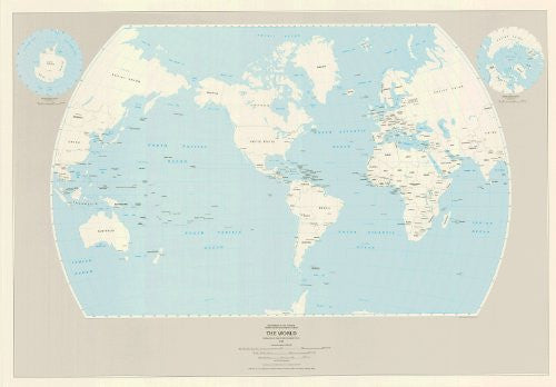
The World (TAA0071) [Map] United States Department of the Interior Geological Survey
The USGS publishes two outline maps of the world. Both are printed in two colors and use the Van der Grinten projection centered on the Americas. The outline format makes them useful as base maps on which you can compile and display special information. This 48"x33.5" map shows the boundaries and names of nations. It shows their capitals and major cities. Map scale is 1:40,053,700 (1 inch equals about 631 miles).
Two polar cap map insets (one each of the North Pole region and the South Pole region) are at scale 1:60,192.000. They are in the Azimuthal Equidistant projection.
Paper, one-sided wall map.
Projection:
*World = Van der Grinten
*North & South Pole insets = Azimuthal Equidistant
Scale:
*World = 1:40,053,700
*North & South Pole insets = 1:60,192.000
Size = 48"x33.5"


