No Products in the Cart
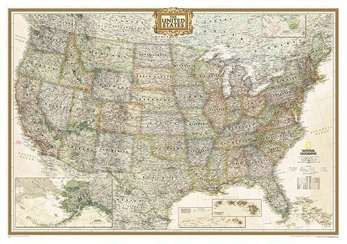
Discover the United States. These detailed reference maps clearly define state boundaries, capitals, major cities, and show shaded physical relief. Use these maps as learning tools or as decoration. The USA Political map is now available in four different styles - giving you more options to match the decor of your home, office, or classroom.
Expertly researched and designed, National Geographic's United States wall map is the standard by which other reference maps of the U.S. are measured.
Product Features:
Dry Erase Lamination is a specialty laminate that allows for dry erase markers to be used on the finished print and erased as desired. This is a convenient and useful at-a-glance reference ready for dry erasable markers, self-adhesive dots or arrows, and/or graphic tape.
Ready-to-Hang maps have rails at the top and the bottom to keep the map flat against the wall with two loops on the top rail for easy hanging. A package of wall hooks and nails completes the set.
 As Seen On TV