MyTopo
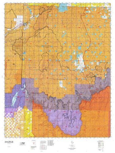
Arizona 13B Hunt Area / Game Management Unit (GMU) Map
Arizona GMU 13B, Hunting Unit Map, 36" × 48"
MyTopo Hunt Area / Game Management Unit (GMU) Maps are 1:100,000-scale maps using the Bureau of Land Management Land Status base maps. These maps include public land ownership boundaries, topography, roads, and key terrain features. The selected State hunt unit or game management unit boundary is overlaid on the BLM base.
New Road Updates: MyTopo GMU maps now contain updated National Forest and public land roads sourced directly from the US Forest Service and other government agencies.
New Tank and Water Source Locations: Arizona GMU maps show official Arizona Game and Fish water source locations (tanks, reservoirs, and springs).
This topographic surface management map covers all of AZ Game Management Unit 13B. It has been assembled using USGS and BLM mapping data with a red game management unit boundary overprint. It features surface management data, varying topographic contour intervals, as well as lat/long and UTM grid coordinates.
- One-sided, self-cover, plastic folded map
- Scale: 1:100,000
- Size: 36" × 48"
- Species: All
- Hunting unit map of Arizona Game Management Unit 13B with topographic lines and unit boundaries. This topo map features UTM / MGRS and Latitude / Longitude grids, plus public land ownership. It comes folded on waterproof paper.
- This map contains the following named places: Agway Pond, Alcorn Pond, Alice Pond, Alva Shelly Reservoir, Ambush Water Pocket, Andrus Point, Ann Pond, Antelope Knoll, Antelope Knoll Pond, Beaver Dam, Belnap Reservoir, Berry Knoll, Big D Reservoir, Big Pond, Billy Goat Peak, Bishop and Burr Reservoir, Black Canyon Reservoir, Black Knolls, Black Rock Mountain, Blake Pond, Bliss Pond, Bliss Pond Number Three, Bliss Pond Number Two, Blue Mountain, Bobcat Reservoir, Boundary Hill, Brown Knoll, Browns Reservoir, Bull Point, Bull Pond, Bunkerville, Burnt Canyon Point, Canyon View Estates Mobile Home Park, Castle Peak, Cattle Guard Pond, Cecil Pond, Cedar Pocket Reservoir, Cedar Pond, Cement Dam Reservoir, Chefs Pond, Chic Pond, Christman Pond, Cinder Knoll, Cinder Knoll Pond, Cold Spring Point, Cold Spring Wash Pond, Cook Pond, Corral Pond, Cox Pond, Craigs Knoll, Crosby Reservoir, Dave Pond, Deadman Knoll, Death Valley Lake, Diamond Butte, Dike Pond, Dime Pond, Ditch Pond, Dolittle Pond, Driveway Pond, D-Six Pond, Earl Pond, East Mesa, Eds Pond, Emily Pond, Empey Pond, End Trough, Ester Pond, Fence Pond, Ferg Pond, Field Pond, Flat Pond, Flat Top, Flat Top Mesa, Flatbottom Pond, Flattop Reservoir, Four Bits Pond, Gardner Reservoir, Gordon Pond, Grassie Point Reservoir, Grassy Mountain, Gravel Draw Pond, Griffith Knoll, Guaranteed Pond, Gyp Reservoir, Hallmark Pond, Hard Pond, Harolds Reservoir, Haskins Pond, Hat Knoll, Head of Hidden Pond, Hells Hole, Hidden Lake, High Bliss Pond, Hobble Pond, Hole-n-Wall Reservoir, Hy Pond, Ivanpah Pond, Ivanpatch Pond Number One, Ivanpatch Pond Number Two, J W Spendlove Reservoir, James Pond, James Reservoir, Jodys Lake, Joe Blake Hill, Jones Hill, Jones Pond, Kellands Pond, Keller Pond, Kinney Point, Kirk Pond, Lamar Reservoir, Lang Pond, Last Chance Knoll, Last Chance Points, Lava Bed, Limestone Reservoir, Link Point, Little Boulder Pond, Little Christman Reservoir, Little Clayhole Reservoir, Little George Pond, Little Jones Pond, Little Main Street Pond, Little Schultz Pond, Little Sevy Draw Pond, Littlefield, Lone Mesa, Lone Mountain, Lonesome Valley Pond, Low Mountain, Low Mountain Reservoir, Lundgren Pond, M and M Pond, Mable Pond, Maple Reservoir, Maryland Knoll, McBryde Reservoir, McCullan Reservoir, Meadview, Mesquite, Middle Pond, Million Hills, Mokaac Mountain, Mollies Nipple, Moriah Knoll, Mount Bangs, Mount Dellenbaugh, Mount Emma, Mount Logan, Mount Trumbull, Mud Hills, Mud Mountain, Mule Point Pond, Mustang Knoll, Mustang Pond, Mustang Reservoir, Myron Pond, Navajo Pond, Negrohead, Nevershine, North Whitmore Point Pond, Nutter Pond, Nutter Reservoir, Oak Grove, Olaf Knolls, Overnight Pond, Pen Pocket, Peters Pocket, Petty Knoll, Pine Pond, Pipeline Pond, Pocket Hill, Poverty Knoll, Poverty Mountain, Powell Mountain, Price Point, Prospect Point, Pugh Knoll, Pymn Canyon Pond, Quail Draw Reservoir, Quail Hill, Quail Point, Quarter Pond, Red Pond, Red Rock Knoll, Road Reservoir, Rock Crossing, Rockhole Pocket Reservoir, Roland Pond, Roys Pond, Sabotage Pond, Seegmiller Mountain, Seven Knolls, Seven Knolls Bench Reservoir, Shoe Buckle Reservoir, Sims Pond, Sinkhole Pond, Slide Mountain, South Cove, South McBryde Pond, South Nutter Reservoir, Spencer Knoll, Squaw Pockets, Stock Driveway Reservoir, Sullivan Reservoir, The Black Rocks, Thumb Knob, Tincanebitts Point, Tony Pond, Toroweap Lake, Trail Pond, Tree Pond, Tub Pond, Tuttle Pond, Tuweep, Tweeds Points, Twin Butte, Upper Antelope, Upper Bull Pond, Upper George Pond, Virgin Peak, Vulcans Throne, Wally Holler Pond, Weed Pond, West Cox Pond, West Hy Pond, West Mesa, Whitmore Point Pond, Witch Pool, Wolf Hole Lake, Wolf Hole Mountain, Wolf Hole Wildlife Reservoir, Yellow John Mountain, and Yellow Pond


