No Products in the Cart
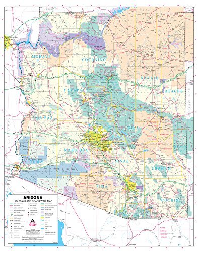
This detailed, up-to-date, and dry erase laminated State of Arizona wall map defines all of the interstate, state, and tribal highways systems. Also included are cities and towns with relevant population information; townships by township and range grid; rivers, streams, lakes, and mountain ranges; counties, Native American tribal lands, military reservations, wilderness areas, wildlife refuges, and National Parks, Forests, and Monuments. Dry erase markers are sold separately.
Dry Erase Lamination is specialty laminate that allows for dry erase markers to be used on the finished print and erased as desired.
 As Seen On TV