Phoenix Mapping Service
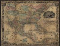
Map of the United States of America, The British Provinces, Mexico, The West Indies and Central America with part of New Grenada and Venezuela (Gloss Laminated) [Map] United States Geological Survey and J.H. Colton and Company
$ 50.80
- Product Details
- Product Number: 113632G
- Scale: Miscellaneous
- Alternate ID: 113632GLAM
- ISBN: 978-0-607-99741-5
- Version Date: 01/01/1857
- Countries: USA
- Latitude: 8° 0' 0" N to 48° 0' 0" N
- Longitude: 50° 0' 0" W to 128° 0' 0" W
- Media: Gloss Laminated Paper
- Format: Flat
- Additional Details
- Description: Map of the United States of America, The British Provinces, Mexico, The West Indies and Central America with part of New Grenada and Venezuela was originally published by J.H. Colton and Co., New York, 1857. Two insets show: "A map of the Atlantic Ocean showing the American and European ports"; and "The Isthmus of Panama". (Reproduction.) This is a digital reproduction from a scanned image, the resolution will be lower than the previous printed edition. Gloss Lamination features premium optically clear film which provides a high shine for dramatic color presentation.
- Survey Date: 1857
- Print Date: 2002
- Height In Inches: 38.500
- Length In Inches: 47.500
- Boundary Type: Political Unit
- Two Sided: No
- Pieces: 1

