No Products in the Cart
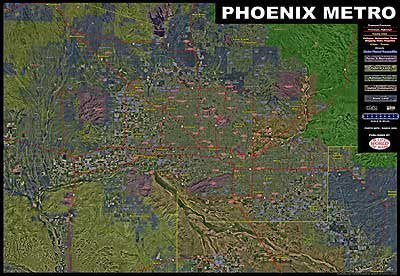
This Phoenix metropolitan map has it all! Aerial imagery is complimented with digital data color shading and overlays. This map covers from Wickenburg to Maricopa, and from Tonopah to Florence! Overlays show streets, highways, freeways, proposed freeways, county borders, cities and towns, master planned communities, colleges, universities, parks, shopping malls, and hospitals. Color tints convey parks and recreation areas, federal land, national forests, Native American communities, and state land. This is a convenient and useful at-a-glance reference.
Paper, one-sided wall map.
Size: 58" x 40"
 As Seen On TV