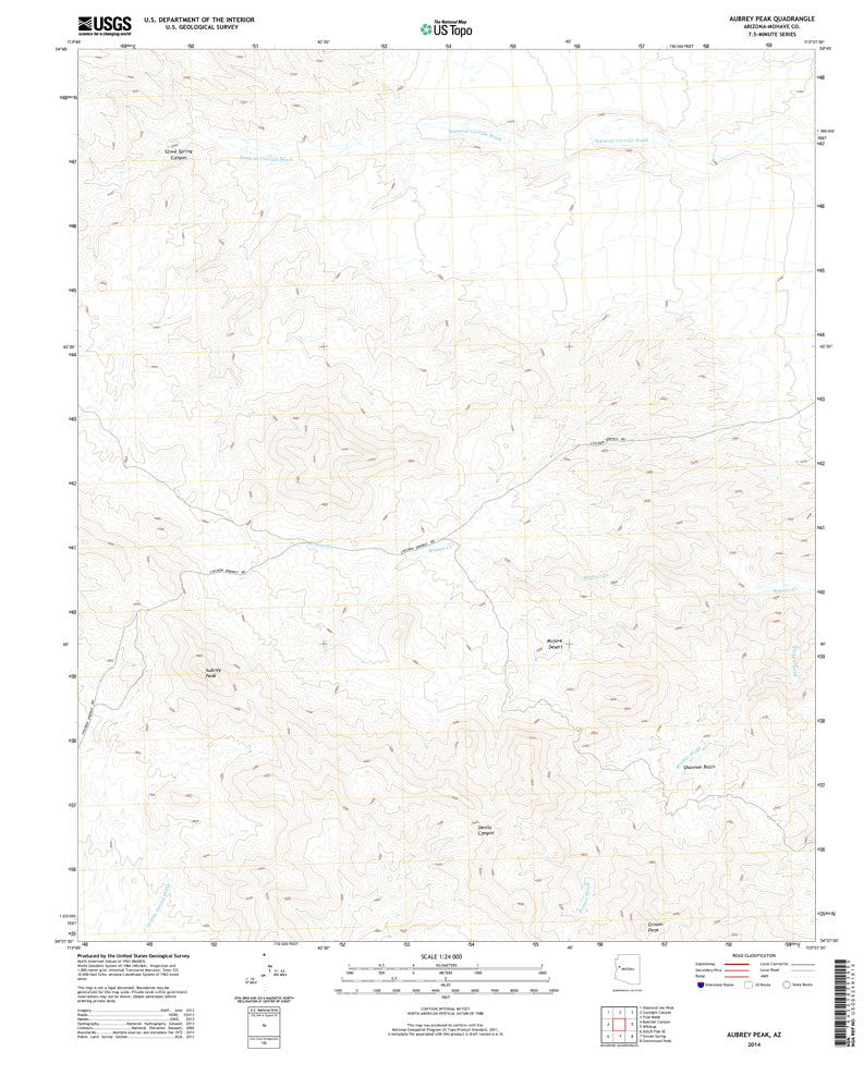
Aubrey Peak, AZ UST 2014 United States Geological Survey 7.5-minute topographic quadrangle map is also available in a 1967 edition as USGS Wikieup NW, AZ 1967.
- Product Details
- Scale: 1:24,000
- Content: Contours
- Version Date: 01/01/2014
- Regions: AZ
- Countries: USA
- Latitude: 34° 45 0" N to 34° 37' 30" N
- Longitude: 113° 45' 0" W to 113° 37' 30" W
- Media: Paper
- Format: Flat
- Historical Reproduction: No
- Additional Details
- Description: Aubrey Peak, Arizona (formerly Wikieup Northwest) The National Map 7.5'×7.5' Grid 1:24,000-Scale 2014
- Survey Date: 2014
- Print Date: 2014
- Height In Inches: 27.000
- Length In Inches: 22.000
- Boundary Type: Quadrangle
- UTM Grid: Grid
- Horizontal Datum: North American 1983
- Vertical Datum: National Geodetic 1988
- UTM: Zone 12
- Two-Sided: No
- Plates: 1
- Pieces: 1
- Languages: English
 As Seen On TV