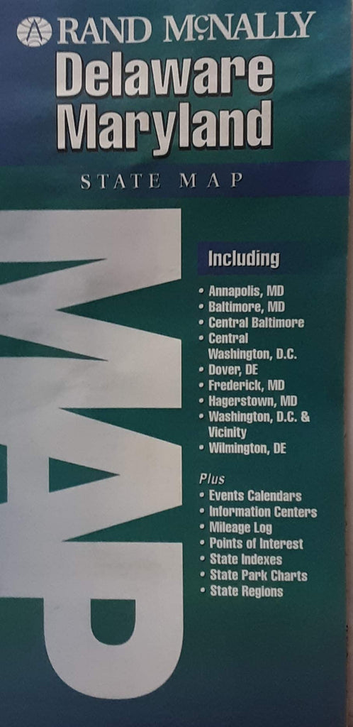
Rand McNally's folded map for Delaware and Maryland is a must-have for anyone traveling in or through these states, offering unbeatable accuracy and reliability at a great price. Our trusted cartography shows all Interstate, U.S., state, and county highways and much more.
- Description
- Points of interest
- State park chart
- State mileage chart
- Driving times map
- On-the-road toolbox
- Visitor center information
- Climate data
- State facts & symbols
- Easy-to-use legend
- Detailed indexed
- Copyright 1994
- Coverage Area
- Detailed maps include: Dover, DE; Wilmington, DE; Annapolis, MD; Baltimore, MD; Baltimore Downtown, MD; Frederick, MD; Hagerstown, MD; Washington, D.C., and Washington, D.C. Downtown
- Product Details
- Measures 4" × 9.0" and folds out to 36.75" × 25.5"
- Two-sided, self-cover, paper/non-laminated folded map
 As Seen On TV