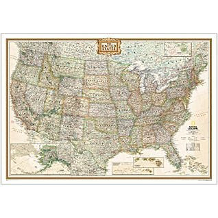
Expertly researched and designed, National Geographic's United States wall map is the standard by which other reference maps of the U.S. are measured.
Product Features:
- Antique-style "executive" color palette with modern mapping
- USA wall map of all 50 states with insets for Alaska and Hawai'i plus inset showing principal Hawai'ian Islands
- Clearly defined state and country boundaries, cities, islands, national parks, and physical features
- Thousands of place names carefully and artfully placed to maintain legibility in heavily populated areas
- Background shows mountain ranges and valleys in subtle shaded relief with mountain ranges labeled
- Major water bodies including rivers, lakes, gulfs, bays, and straits
- Transportation routes including interstate highways, major state routes, airports, waterways, canals, and ferries
- The map is packaged in a two inch diameter clear plastic sleeve
- Map Scale = 1:4,557,000
- Sheet Size = 43" × 30" (109.2cm × 76.2cm)
- For home or office.
- 44292P

 Everything is Somewhere
 As Seen On TV