No Products in the Cart
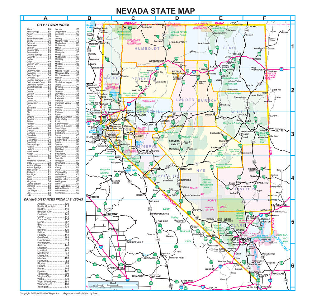
This detailed and up-to-date gloss laminated wall map shows all of the interstate and state highways systems of Nevada, USA. Also included are counties, cities, towns, rivers, lakes, national forests, national parks, national recreation areas, state recreation areas, wildlife management areas, wildlife refuges, wildlife ranges, Air Force ranges, Air Force auxiliary fields, test sites, Army munitions, and indigenous reservations. Featured on the left is a complete cities and towns index plus a table of the driving distances from Las Vegas.
Gloss Lamination features premium optically clear film which provides a high shine for dramatic color presentation.
Gloss laminated paper, one-sided wall map.
Size: 21" x 21-1/2"
 As Seen On TV