No Products in the Cart
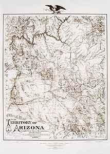
This faithful reproduction of the Arizona Territory in 1880, drawn by civil engineers of the time, shows mining districts and county lines, telegraph lines, and Indian country. A historical reproduction, the original map was created for the Library of Congress and compiled from surveys, reconnaissances, and other sources.
Paper, one-sided wall map.
Size: 30" × 42"
 As Seen On TV